The final report for the 2018-2020 historical ecology study funded by the John Randolph Haynes and Dora Haynes Foundation can be downloaded here.
Final Report (high resolution; 86 MB)
Final Report (compressed; 10 MB)
Executive Summary
As the Los Angeles metropolis continues to grow in the 21st century, so has public and governmental support for sustainable development. Open space is increasingly valued for its social, historical, and ecological values, and the practice of environmental restoration and management of remnant open spaces has expanded. Major ecological rejuvenation efforts are proposed or underway throughout the region, but these sustainable development and landscape restoration projects urgently need reliable, evidence-based knowledge about the underlying natural ecology. What natural vegetation would historically have thrived in different areas of the metropolis? Which animals fed on that vegetation and who were the predators? Where were the ever-shifting rivers, tributaries, creeks, and the springs? What time periods of the region’s past should be used for models of restored landscapes?
While detailed, neighborhood-scale projects have described the historical ecology of some portions of the region, a general study of the entire Los Angeles River and Watershed has been lacking. In this two-year research project funded by the John Randolph Haynes and Dora Haynes Foundation, we developed the foundation for a uniform, evidence-based understanding of the historical natural habitats of the Los Angeles River and Watershed—and of the Los Angeles Basin generally. Due to the great size of this area: approximately 1,988 square miles (3,200 km2), we set the goal of establishing a durable, public-use knowledgebase for this area at a medium, 1-kilometer scale, so that a growing body of researchers can pursue the next phase of the project: to build detailed neighborhood-level studies at the scale of 100 meters or less.
The primary results of this project are:
- The first-ever public-use geo-historical database of map layers, data, historical images, and textual records that covers the entire Los Angeles River and Watershed, which can be used and augmented collaboratively by a growing body of researchers. It combines all known historical maps and sources, plus newly discovered sources, as layers and geolocated objects in a common geographic reference grid, so that researchers and the general public can view all currently known sources pertaining to any location in the Los Angeles Basin.
- The first comprehensive chronological framework for understanding the different historical eras and sub-periods of the very ancient past of the Los Angeles region. This chronological framework, built from Indigenous and modern scientific knowledge, makes it possible to specify the ecological dynamics pertaining to any given historical date, beginning about 2.5 million years ago and continuing through more than 9,000 years of human civilization.
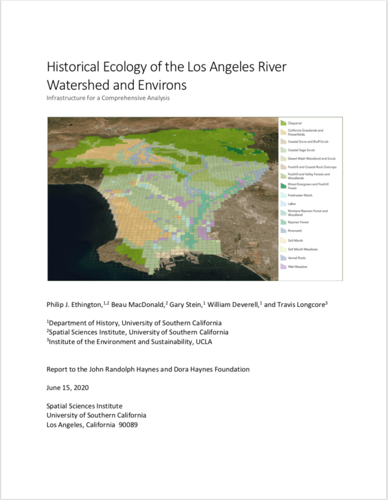
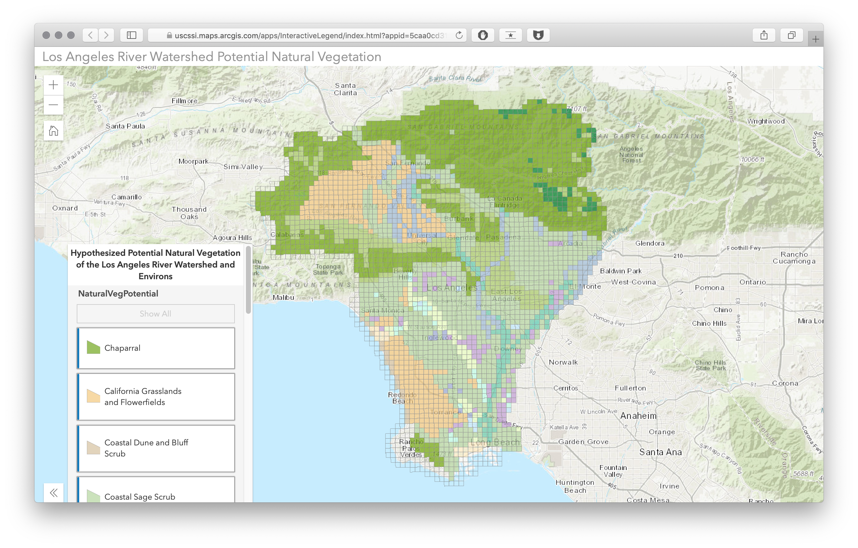
- An initial assessment at the 1-km scale of the potential natural vegetation (PNV) of all areas of the Los Angeles Basin, classified by “macrogroup” designations of landscape types, such chaparral, grasslands and flowerfields, foothill and valley forests and woodlands, riparian forest, salt marsh, alkali meadow, wet meadow, and freshwater marsh for the entire 3,200 km2 (1,988 sq. mi.) area of the Los Angeles Basin. This layer can be explored interactively in the webmap here.
- A new assessment of the extent of habitat loss across the Los Angeles Basin due to urbanization over the last two centuries. Within the present-day extent of the Los Angeles River Watershed, most vegetation groups have experienced at least some urban development in all 1-km2 blocks where they occurred historically. For California chaparral, 69% of the blocks have some urban development, 85% for foothill and valley forests and woodlands, 98% for riverwash, 99% for coastal sage scrub. No single 1-km2 block persists without some urban development within it for California grasslands and flowerfields, riparian forest, wet meadow, salt marsh meadow, freshwater marsh, lakes, and vernal pools.
